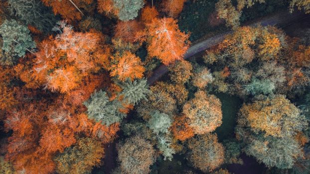
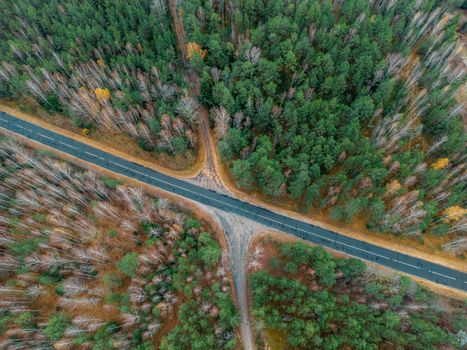
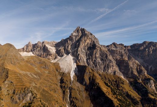
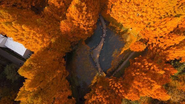
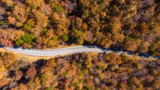
There’s a moment, right after you hit the take-off button, when your drone whirs to life and ascends, steadily shrinking into the sky. It’s a moment of pure magic. Suddenly, the world beneath you transforms. That winding road becomes a ribbon, the vast forest a textured carpet, and the towering mountain a grand sculpture revealing hidden contours. I remember my first truly epic drone shot – a sunrise over the basalt columns of Reynisdrangar in Iceland. The light was liquid gold, the waves crashed in a mesmerizing rhythm, and from 100 meters up, I saw the sheer, raw power of nature in a way no ground-level photo could ever convey. It was utterly transformative, and honestly, a little addictive.
But let’s be real: the thrill of drone photography comes with its own set of challenges. Chief among them? Navigating the labyrinthine world of regulations. What’s allowed one year might be banned the next. What’s fine in one country is a felony in another. And when you’re planning a trip for November 2025, you want certainty, not headaches. That’s why I’ve poured through countless official sites, spoken to fellow drone enthusiasts, and tapped into my own travel experiences to bring you this comprehensive guide.
This isn’t just a list; it’s your actionable playbook for capturing November 2025’s most stunning aerial vistas, legally and responsibly. Whether you’re chasing autumn's last fiery breath in the Northern Hemisphere or embracing the vibrant spring of the Southern, get ready to elevate your travel photography game.
The Global Drone Landscape: Navigating November 2025 Regulations
Before we dive into the juicy locations, let's establish a golden rule: ALWAYS CHECK THE LATEST LOCAL REGULATIONS. Seriously, this isn't a suggestion; it's a non-negotiable commandment. Drone laws are dynamic, evolving faster than a firmware update. What I outline here is based on current trends and my best predictions for November 2025, but you must verify closer to your travel date.
My Go-To Pre-Flight Checklist for Any Destination:
- Official Aviation Authority: Every country has one (e.g., FAA in the US, CAA in the UK, EASA for much of Europe). Their websites are the ultimate source of truth.
- Local Tourism Boards/Park Websites: Many national parks, protected areas, or even specific cities have their own additional restrictions or require permits. Don't assume national law covers everything.
- Drone Apps: Apps like DJI FlySafe (built into DJI drones), B4UFLY (US), or AirShare (NZ) provide excellent, often real-time, no-fly zone information.
- Community Forums: Websites like DronePilots.com or country-specific Facebook groups can offer invaluable insights from fellow travelers who’ve recently flown there.
- Insurance: Don't skimp. Liability insurance is often mandatory and always a good idea.
Common restrictions to be aware of: no-fly zones around airports, military installations, government buildings, large public gatherings, and sometimes even private property without explicit permission. Altitude limits (usually 120m/400ft) and maintaining Visual Line of Sight (VLOS) are almost universal. For November, consider how shorter daylight hours and potentially colder weather might impact your flight planning and battery life.
Northern Hemisphere Wonders: Chasing Autumn's Last Glow & Early Winter Whispers
November in the Northern Hemisphere offers a unique blend: the tail end of autumn's vibrant spectacle in some regions, and the first dusting of winter snow in others. This transitional period often means fewer crowds and dramatic, moody light – perfect for aerial storytelling.
1. The Scottish Highlands, UK: Misty Looms & Dramatic Landscapes
- Why November 2025? The Highlands in November are a photographer's dream for mood and drama. While the peak autumn colours might have faded in some areas, the stark beauty remains. Think rolling hills cloaked in heather, brooding lochs reflecting an often-turbulent sky, and the crisp, clean air. You might even catch the first whispers of snow on the peaks, adding an ethereal quality. Plus, fewer midges (a huge bonus!) and significantly smaller crowds than in summer.
- Drone Details: The UK Civil Aviation Authority (CAA) governs drone use. Recreational flyers generally need to register as an operator and pass a basic online test. Key rules include not flying within 50m of people, 150m of congested areas, or over crowds. Many areas, especially those managed by the National Trust for Scotland or specific estates, require explicit permission for drone operations. My advice? Focus on the vast, open landscapes.
- Specific Spots:
- Isle of Skye: While popular, November strips back the crowds, revealing the raw, untamed beauty of the Old Man of Storr, Quiraing, and the Fairy Pools. Fly early for incredible mist and light.
- Glencoe: The sheer scale of this valley is breathtaking from above. The Three Sisters, the winding A82 – it’s cinematic. I once captured a lone stag silhouetted against a misty Glencoe morning; an unforgettable moment.
- Loch Lomond & The Trossachs National Park (specific permitted areas): Check park-specific rules, as some areas are stricter. The vastness of the loch and surrounding forests offer incredible perspectives.
- My Anecdote: I remember a chilly November morning on Skye, the kind where your breath plumes in the air. I launched my Mavic 3 near the Old Man of Storr, and as it ascended, the low-hanging clouds parted just enough to reveal the iconic pinnacles bathed in a soft, ethereal light. The drone’s perspective allowed me to show the sheer scale of the landscape against the tiny figures of hikers below. It felt like I was painting with light and shadow.
- Practical Tips: Pack extra batteries – the cold saps power quickly. Waterproof gear for yourself and your drone bag is a must. Always check wind speeds; the Highlands can be notoriously gusty.
2. The Dolomites, Italy: Alpine Majesty & Early Snow Dustings
- Why November 2025? The Dolomites in November are a transition zone. The summer hiking crowds have vanished, and the ski season hasn’t quite kicked off, offering a serene, almost solitary experience. While the vibrant larch trees have likely shed their golden needles, the dramatic, jagged peaks of the UNESCO World Heritage site gain an incredible sense of grandeur with an early dusting of snow. The light can be incredibly crisp and clean, creating sharp contrasts.
- Drone Details: Italy's National Civil Aviation Authority (ENAC) governs drone use. Recreational drones under 250g have fewer restrictions but still require registration and adherence to general safety rules. For heavier drones, an A1/A3 Open Category certificate is needed. Crucially, many parts of the Dolomites fall within national parks or protected areas (e.g., Parco Naturale Tre Cime, Parco Naturale Fanes-Senes-Braies), which often have strict no-drone policies or require specific permits. Always check with the local park authority well in advance.
- Specific Spots (with careful planning):
- Seceda Ridgeline (from permitted areas): The iconic jagged peaks are even more dramatic with a touch of snow. You can often find spots on the approach or in surrounding valleys that offer incredible views without infringing on park rules.
- Lago di Braies (from permitted areas): While popular, November offers a quieter experience. The emerald lake surrounded by towering pines and snow-dusted peaks is postcard-perfect.
- Val di Funes: The charming churches of Santa Maddalena and San Giovanni in Ranui, set against the Geisler Group peaks, are a classic shot. From above, you can capture the patchwork fields and winding roads leading to these iconic spots.
- My Anecdote: Flying near Val di Funes one November, the air was utterly still, the silence broken only by the drone’s hum. I launched from a small, permitted hillside, carefully avoiding the immediate vicinity of the churches. As the drone rose, the sun dipped behind the Geisler peaks, casting long, dramatic shadows across the valley. The aerial perspective allowed me to frame the tiny San Giovanni in Ranui chapel as a jewel nestled amidst an immense, snow-kissed landscape. It felt like I was uncovering a secret only the birds knew.
- Practical Tips: Be prepared for sudden weather changes. Always have a spotter if possible. Respect private property and local signage.
3. Cappadocia, Turkey: Fairy Chimneys & Lunar Landscapes
- Why November 2025? Cappadocia is magical year-round, but November offers a unique charm. The intense summer heat has faded, replaced by crisp, comfortable air. The landscape of "fairy chimneys" and ancient cave dwellings takes on a more muted, earthy tone, enhancing its otherworldly feel. While hot air balloon flights are weather-dependent, if they're flying, capturing them from a safe, legal distance (and never flying near or above them) can be an iconic shot. Even without balloons, the valleys themselves are a drone pilot’s paradise.
- Drone Details: Turkey's Directorate General of Civil Aviation (DGCA) regulates drones. Drones over 500g generally require registration and a pilot license. For smaller recreational drones, rules are less stringent but still require common sense: no flying over crowds, within 9km of airports, or near military zones. Permits are often required for specific commercial operations, and some highly tourist-dense areas might have local restrictions.
- Specific Spots:
- Love Valley: Its phallic rock formations are iconic, and from above, their sheer scale and unique shapes are truly revealed.
- Rose Valley & Red Valley: These valleys are famous for their stunning sunsets, which paint the rock formations in incredible hues of pink and red. An aerial view captures the intricate patterns and ancient cave dwellings carved into the cliffs.
- Pigeon Valley: Named for the pigeon houses carved into the rocks, this valley offers a different texture and history from above.
- My Anecdote: I was there in mid-November, and the air had a wonderful bite to it. One morning, I woke before dawn, walked to a permitted launch spot overlooking Pigeon Valley, and sent my drone up. As the sun began to peek over the horizon, it slowly illuminated the undulating landscape, revealing countless tiny cave windows and the intricate network of pigeon houses. The drone’s perspective allowed me to show the vastness of human history etched into this incredible natural canvas. The silence, broken only by the distant calls to prayer, was profound.
- Practical Tips: Early morning is best for light and avoiding any potential crowds. Be mindful of privacy, especially near cave hotels and local villages. Watch out for sudden gusts of wind that can sweep through the valleys.
Southern Hemisphere Gems: Spring into Summer's Embrace
While the North winds down, the Southern Hemisphere is bursting to life. November marks late spring or early summer, offering lush landscapes, vibrant colours, and longer daylight hours – perfect for extensive drone exploration.
1. Patagonia, Argentina & Chile: Glaciers, Lakes & Towering Peaks
- Why November 2025? November is prime time in Patagonia. The harsh winter winds have eased, wildflowers are beginning to bloom, and the longer days mean more opportunities for exploration. The glaciers are still magnificent, and the iconic peaks of Fitz Roy and Torres del Paine are often clearer than in peak summer. Crucially, the extreme winds that characterize much of Patagonia are generally less intense in November, making drone flying more feasible.
- Drone Details: This is where it gets tricky but incredibly rewarding. Most national parks in Patagonia (e.g., Torres del Paine in Chile, Los Glaciares in Argentina) have strict no-drone policies inside park boundaries. This is due to wildlife protection (especially condors), safety, and preserving the wilderness experience. However, there are numerous stunning areas just outside park boundaries or in less restricted regions that offer equally breathtaking views.
- Specific Spots (outside strict park zones):
- El Chaltén Region (Argentina): While Mount Fitz Roy is within Los Glaciares National Park, many areas around El Chaltén offer incredible, legal drone opportunities. Think the winding Rio de las Vueltas, the vast Patagonian steppe leading to the mountains, and specific viewpoints that allow you to capture the range from a distance.
- Puerto Natales & Surrounding Areas (Chile): Before entering Torres del Paine, the fjords, lakes, and vast pampas around Puerto Natales offer incredible opportunities to capture the region's scale.
- Carretera Austral (Chile): This epic road trip offers countless vistas of lakes, mountains, and forests. Many areas are outside national park restrictions.
- My Anecdote: I learned my Patagonia drone lesson the hard way – nearly getting a drone confiscated trying to fly too close to a park entrance. But the next year, armed with better research, I launched from a permitted spot outside El Chaltén, capturing the winding turquoise Rio de las Vueltas leading towards the impossibly jagged Fitz Roy massif. The drone allowed me to show the river as a living artery flowing through a landscape of giants. The sheer scale, the vibrant blue of the water contrasting with the muted greens and greys, was something I could never have conveyed from the ground.
- Practical Tips: Wind is your biggest enemy here. Always check forecasts. Carry plenty of extra batteries and keep them warm. Be acutely aware of wildlife – never harass or disturb animals. Respect local guides and their knowledge of permitted areas.
2. New Zealand (South Island): Lord of the Rings from Above
- Why November 2025? November in New Zealand is late spring, a time of lush greenery, vibrant blooms (the lupins around Lake Tekapo typically start in late November/early December), and still-snow-capped peaks. The crowds haven't reached their summer peak, meaning more serene locations for drone flying. The South Island, in particular, with its dramatic fjords, glacial lakes, and towering mountains, is a drone pilot's playground.
- Drone Details: New Zealand's Civil Aviation Authority (CAA NZ) has a clear, well-structured drone framework. The AirShare app is absolutely essential; it shows real-time no-fly zones, restricted airspace, and allows you to request permission for controlled airspace flights. Many national parks (e.g., Fiordland National Park, Aoraki/Mount Cook National Park) have strict no-drone rules. However, there are countless permitted areas.
- Specific Spots (with AirShare verification):
- Wanaka & Queenstown (with caution): Both offer stunning lake and mountain views. Be extremely cautious around Queenstown due to its airport; always use AirShare and request permission if needed. Lake Wanaka and its surrounding hills, however, offer more accessible drone opportunities.
- Glenorchy & Paradise: The "Gateway to Paradise" near Queenstown offers incredible, cinematic landscapes that feel straight out of Middle-earth. Many areas here are outside strict park boundaries.
- Milford Sound (from permitted areas): While flying within Milford Sound itself is heavily restricted, there are areas on the approach or in the wider Fiordland region that offer breathtaking views of the dramatic fjords and waterfalls.
- Lake Pukaki & Lake Tekapo (with caution): The iconic turquoise lakes are stunning. Be mindful of tourist crowds and private property.
- My Anecdote: I was mesmerized flying over the glacial blue waters of Lake Pukaki in late November. The sun was high, making the water glow, and the snow-capped peaks of the Southern Alps formed a majestic backdrop. Using AirShare, I found a perfect, legal launch spot away from the main road and watched my drone capture the incredible contrast between the vivid blue lake and the rugged mountains. It was like seeing a painting come to life, but with the added dimension of depth only an aerial view can provide.
- Practical Tips: Always use AirShare. Respect privacy. Be mindful of sheep and other livestock. New Zealand weather can be unpredictable, so check forecasts constantly.
Unique & Unexpected Destinations for November Aerials
Sometimes, the best drone shots come from places less explored, or places that offer a radically different perspective.
1. Namib Desert, Namibia: Ancient Dunes & Ghostly Trees
- Why November 2025? November in Namibia is the transition from dry to wet season. While temperatures can be high, the light can be incredibly dramatic, especially at sunrise and sunset, casting long, sharp shadows over the iconic dunes. The lack of vegetation in many areas makes for clean, impactful aerial compositions.
- Drone Details: Namibia's Civil Aviation Authority (NACA) regulates drones. Permits are generally required for flying within national parks (like Namib-Naukluft National Park, home to Sossusvlei and Dead Vlei). This means significant pre-planning is essential. Often, working with a local tour operator who can arrange permits is the easiest way to navigate this.
- Specific Spots (with permits):
- Sossusvlei & Dead Vlei: The rusty-red dunes, the stark white clay pan, and the skeletal camel thorn trees create an unparalleled landscape. An aerial view reveals the incredible scale and patterns of the dunes.
- Skeleton Coast (from permitted areas): The dramatic meeting of desert and ocean, with shipwrecks scattered along the shore, is incredibly powerful from above.
- My Anecdote: The sheer silence of the Namib Desert at dawn, broken only by the gentle hum of my drone, is etched in my memory. After securing the necessary permits (which took months of planning!), I launched my drone over Dead Vlei. From above, the ancient, blackened trees looked like abstract art against the white pan, surrounded by the towering, orange dunes. The drone captured the incredible shadows and textures, creating a sense of timelessness and isolation that was truly profound. It was a logistical challenge, but every photo was worth it.
- Practical Tips: Dust is a major enemy – protect your drone. Heat affects battery life, so keep them cool. Respect the delicate ecosystem and always follow guided instructions within protected areas.
2. Dubai & UAE: Futuristic Skylines & Desert Sands
- Why November 2025? November offers arguably the best weather in Dubai and the UAE – warm, sunny days with cooler evenings, perfect for outdoor activities and comfortable drone flying. The contrast between the futuristic skyscrapers, intricate urban planning, and the vast, undulating desert is a drone photographer's dream.
- Drone Details: The UAE's General Civil Aviation Authority (GCAA) has some of the strictest drone regulations in the world. Mandatory registration is required for all drones, and specific permits are needed for almost any flight, even recreational ones. There are extensive no-fly zones (around airports, palaces, residential areas, and many major landmarks). Pre-planning is absolutely critical here. You'll need to apply for flight permits well in advance through the GCAA or Dubai Civil Aviation Authority (DCAA) portals.
- Specific Spots (with permits & caution):
- Downtown Dubai (from permitted vantage points): Capturing the Burj Khalifa, the Dubai Fountain, and the intricate road networks from above is truly spectacular. You'll need specific permissions for this.
- Dubai Marina: The dense cluster of skyscrapers and yachts in the marina offers a stunning urban tapestry.
- Desert Safaris: Outside the city, the endless dunes of the Arabian Desert provide a contrasting landscape. Many desert camps offer drone-friendly areas, but always verify.
- My Anecdote: The first time I flew my drone in Dubai, it was after weeks of permit applications and careful planning. I had a specific window for a sunrise shot over a permitted desert area outside the city. As the sun rose, painting the dunes in incredible shades of orange and red, my drone captured the intricate patterns of the sand, the solitary camel trains, and the vastness of the desert against the distant, hazy outline of the city. It was a testament to the power of meticulous planning – and the reward was an aerial perspective that truly showcased Dubai's unique blend of tradition and futurism.
- Practical Tips: Start the permit application process months in advance. Be meticulously compliant with all rules; enforcement is strict. Never fly over people or private property without explicit consent.
Essential Drone Photography Tips for November Travel
Beyond legalities, here are some practical tips to maximize your drone photography in November:
- Battery Management in Cold Weather: Cold drastically reduces battery life. Keep batteries warm (e.g., in an inside jacket pocket) until just before flight. Don't fly on critically low battery in cold conditions.
- Weather Awareness: November can bring unpredictable weather – wind, rain, even early snow. Use reliable weather apps (e.g., Windy, AccuWeather) and always check conditions right before launching. Never fly in rain or strong winds beyond your drone's capability.
- Pre-Flight Checks: Make this a ritual. Check propellers for damage, ensure firmware is updated, calibrate your compass, check your SD card (is it empty? formatted?), and confirm GPS signal.
- Respect & Ethics: This is paramount. Respect local culture, privacy, and wildlife. Never fly too close to animals, especially nesting birds or herds. Be mindful of noise, especially in serene natural environments or residential areas. If in doubt, ask for permission.
- Legal Compliance is Non-Negotiable: I can't stress this enough. Ignorance is not an excuse. A simple fine can be ruinous, and confiscation of your drone can end your trip.
- Gear Up:
- ND Filters: Essential for managing bright light, especially in the Southern Hemisphere, allowing for cinematic motion blur.
- Spare Props: Accidents happen. Always carry spares.
- Power Bank: For charging controllers or phones.
- Cleaning Kit: Microfiber cloths for lenses, especially after dusty or misty flights.
- Composition & Storytelling: Don't just fly up and snap. Think about your shot. Use leading lines (roads, rivers), the rule of thirds, and negative space. How can the drone's perspective tell a story that ground shots can't? Look for patterns, symmetry, and scale.
- Safety First, Always: Keep your drone in Visual Line of Sight (VLOS). Maintain a safe distance from obstacles. Don't take unnecessary risks for a shot. Your drone is replaceable; people and nature are not.
Elevate Your November 2025 Adventures!
The world from above is a different world – one of breathtaking scale, intricate patterns, and unparalleled beauty. November 2025 offers a unique canvas, from the dramatic, moody landscapes of the Northern Hemisphere to the vibrant, blossoming scenes of the South. With careful planning, respect for local regulations, and a dash of adventurous spirit, your drone can unlock perspectives that will not only fill your memory cards but also enrich your soul.
So, where will your drone take you this November? Will you be chasing the last golden light in the Scottish Highlands, witnessing the birth of winter in the Dolomites, or soaring above the ancient dunes of Namibia? The sky is calling, and with this guide, you’re ready to answer.
Share your dream drone spots or best drone travel tips in the comments below! And don't forget to tag us @Tripsora and use #TripsoraDrones on your incredible November 2025 aerial adventures. We can't wait to see what you capture!
---